|
|
Dinay --- according to oral tradition --- is the place where fire and pottery were introduced to the people of Yap.
 February 2, 1999 February 2, 1999
Tomorrow is our big day. We go visit a site to find out where it is and how much work we will have to do to clear it before we begin the rudimentary stuff of mapping. We have to notify the paramount chief of the area before we go out, as well as the local chief/landowner of the village we are going to. He is a good guy, and I like him. I think he wants to see what sort of things we will be doing. But I don't really know if he will be meeting us in the field or not.
February 3, 1999
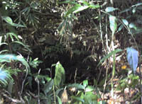
We visited the site where we are going to start work today. It is going to be a lot of grunt labor just to clear out the small vegetation, to even get to the point of mapping the thing. I was taking my time looking at the site, strategizing with myself about how to begin, asking the landowner questions through John Tun. Chief Andrew Reupang is the paramount chief of the area in which our site is located. I didn't realize it was a special place to him when I selected it as our first place --- Chief Andrew and his family hid out there during the war. So, he has a personal interest in the work we do there. As far as I can tell, there are about eight platforms there, very overgrown; many have collapsed, and the jungle has virtually swallowed them. The names of the platforms are not known because the village has been abandoned for quite some time. It doesn't even show up on the German maps, so it was definitely abandoned long before then. And, with no platform names, again, long-time abandonment.
Land is very important because there is so little of it, but also because people come and go while the land goes on. So it is with platforms. People are named after platforms, and their name ties them to the land on which the platform that they are named after rests. That becomes their land; they act essentially as stewards. It is the land that is chief, not the people (this is what one chief told me). So it is the land/platform that has the ties to other lands/platforms, not the people who share the name and who act as chief.
In the discussion of names, Mueller talked about children being named after the father or the mother of the father... but nowhere does he note that it is not the person but the platform that lends its name to the child. That is why it was so important for me to know if the platforms in this village we are working in have names. Technically, they should. But the fact that they don't means something, too; the fact that they are long gone is important.
 |
 |
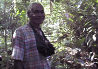
Andrew Figirmad
Field Surveyor, Yap HPO
|
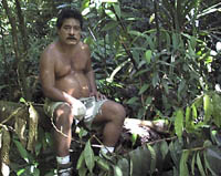
Mario Buchun
Field Surveyor, Yap HPO
|
February 4, 1999
My day went okay. It started slow, as one might expect --- John Tun got into the office by 8:30. Nice, because I wanted to go to the field then. Andrew decided to meet us at the site. Mario came way-late, and Felisa was late. John dropped me at the site and then went to check on Andrew's various haunts to make sure he wasn't at any of them. Later on, he dropped Mario off --- so it was just us three guys hacking away at the vegetation to uncover a stone path. It was pretty neat, though. I wanted to concentrate on clearing the stone path today --- makes for a nice baseline, and it gives you an idea of the beginnings and endings of a village, if all the features remain intact. Tomorrow we start on some platforms. At any rate, it is so cool to begin peeling back vegetation (well, chopping it away) to expose features that have laid obscured for, how long... centuries maybe. And, because there is no current connection with this site --- it doesn't even appear on the German maps --- trying to puzzle out the features and structure of the village is rather fun. For instance, I think we got an entrance point on the path. I originally thought it was a resting platform, but it is such a big area, I am not very sure about my initial impression. And, while clearing the path, I looked up across the stream it follows and saw this incredible platform --- with retaining wall along the creek, and then on top of that level, another one with nicely stacked rocks forming another platform (a house foundation maybe?). As we are supposedly dealing with a very early site, I am not sure just how much of the ethnographic or more recent archaeological remains will coincide with this site. If we find different patterns of, say, house platforms, we might have different patterns of locations, maybe taro patches and so on. We don't necessarily need to rely on current, modern patterns. It may be perfectly acceptable to have square house foundations; more recent patterns have six-sided foundations for many house forms. Those are what are drawn on the maps made in earlier archaeological work.
Of course, I am now sore. I have a blister on my hand from holding my machete; I smashed another finger against a rock, and I am feeling my machete-swinging in my shoulder. It is too bad we don't have a bathtub here.
February 5, 1999
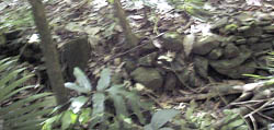
My shoulder is sore, my wrist is sore, even my fingers are sore. We spent today working on cleaning the walls of a platform complex. It is a rather large one, and very pretty! It is right above the streambed where a taro patch has been planted. There is a retaining wall to keep the soil from slumping down into the stream and taro patch, and to keep everything else in place upslope. This retaining wall has a circular indentation in it --- looks almost like a well, and perhaps might have been (I have never seen anything like it reported in the archaeology, for sure) --- and a couple of tiers of terraces below the house platform. It is a six-sided house platform. As far as I can tell, these are unique to Yap. It makes me wonder where they came from, how they developed, and how long they have been around! I also found some pottery on the site --- not a big clue of anything, as this place has supposedly been occupied for some time. This village is, again supposedly, the first place to receive pottery and fire from the spirits. That is part of its importance in the oral histories, as well as being among the first settlements.
According to oral histories, before there was pottery and fire, people had to go to the savannas to dry their food in the sun. They couldn't cook anything, but had to live in a place close to the open hillltops --- the savannas. By extension, the villages would be downslope from the savannas, in the trees, where it is cool. Just like this village.
Anyway, we went searching for other platform complexes to get an idea of the extent of area we have to cover. We found five on the same side of the creek as we were working --- all multi-tiered complexes, very overgrown with vegetation. Jungle. We found another four on the other side of the creek; these are very disturbed because people are farming/gardening there. And, don't forget, our stone path running alongside the creek. It makes for a nice complex.
House foundation
These guys seem to have paid some attention to drainage, as there appear to be drainages cut alongside the stone path, along the platforms, and between platforms within a complex.
John Tun was supposed to pick us up at a certain time, but he was late, so we started walking back to the office and ended up catching a ride. He showed up later at the office; apparently he had gotten to our pick-up site just after we had left. When he didn't see us, he hiked into the site. He said the scariest part was having to yell for us --- because at some of the old sites, especially the abandoned ones, if you yell someone's real name, the spirits will snatch away that person. He was afraid this had happened to us when we didn't respond. He further explained that there are other times when spirits will snatch away the yeller --- so he isn't sure if he will be on this planet come tomorrow. What makes it all the more uncertain is that we have no oral history for this place, at least not yet. Well, John Tharangan might have some, but he is off-island, so we don't know what he has packed away in his head. Anyway, without oral history, we don't know if this is a place where spirits actively roam. (According to Andrew, there are plenty of ghosts there --- but we can't say there are ghosts here because John Tharangan has Teresa convinced there are no ghosts in Yap because it is too noisy. So the word "ghosts" has to be avoided --- and at night you can see a fire lit on the platform by the big banyan tree.)
When we were eating oranges on our break from cleaning, I started rubbing the orange essence from the peel on my skin (you know, the way monkeys do to keep off the mosquitos). Mario wanted to know what I was doing, so he asked. Then Andrew piped in that when you dry the peel you can use it at night to light instead of mosquito coils because it keeps the mosquitos away.
I have asked John Tun to ask Chief Andrew (the paramount chief of the area) if we could have three additional guys to help us clean the platform complexes. We have a lot to do in such a short time --- and besides, I am hurting after all of this.
February 6, 1999
John Tun's wife is going to make Teresa and I grass skirts for Yap Day. John keeps teasing me, saying that means I have to go totally local (i.e., without a top), then he and everyone else laugh when I say I think I should go half me and half local (i.e., with a top). One thing about the guys here --- they love to tease. It can be very funny sometimes.
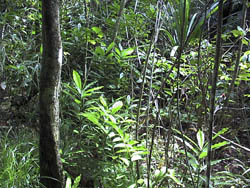
The complex is in a stream drainage, and unfortunately the only thing you see from a high point is the jungle cover. It would be really nice if we didn't have this cover --- it would make the work a whole lot easier. As it is, when we were out hunting for other platform complexes, we generally ended up walking over them before noticing they were house platforms and such. The jungle cover is pretty dense, and the level of disturbance to these things is unbelievable --- mainly because of the vegetation growth. Just try to imagine a platform with stone walls, a dirt interior and a paving of flat stones; then add to it a stream basin, vegetation, and abandonment for several years or longer. Trees start to grow up in the platform, plants live and die, they form the humus on the ground surface that continues to build every year little by little. With enough tree growth, the retaining walls of the platform get pushed out of shape, stones tumble off of it, the whole shape begins to change as the dirt interior begins to slump. Pretty soon, you have kind of rounded forms that begin to look like mounds with some segments of rock walling still in place, though not as vertical as it once was. This is the kind of stuff we are dealing with. Once you get an eye for the form, you begin to question each mound you run into.
But you know what I have noticed with the previous reports: there are no slope retaining walls illustrated, no indication of the amount of work that was put into laying out a village, no discussion on the real construction of a platform, no anything. I mean, these places are real feats of engineering --- and, if I am not mistaken, there was also hydrologic planning with drainages placed along the slope by the platforms and complexes to funnel the water to the taro patches or streambed. Then there is the thought that as the taro patches were dug out, the soil was used to build the platforms. I kind of have a hard time with this one --- it doesn't make sense and gets you into a very circular argument: if you are building up your house platform with the taro garden excavation, where are you living? (The answer given: in your house on the platform.) If you look at the taro gardens, what you see is mounded berms around the places; some of it could have been used to fill in the tiers or terraces of the housing complexes, but I don't think it was used to fill house platforms. I think the taro gardens came after the housing, frankly --- you don't just go up to an uninhabited place, dig a basin for your taro and then plan your housing around that. Anyway, that is my impression.
We are launching their oral history program with the site work, so I need to give him a bunch of questions related to the information I want to pull ouf of the site. I told him that my questions will be related to the archaeology, and that for a full-blown oral history program it would go beyond my questions to cover all kinds of topics important to Yap itself.
February 8, 1999
I cut a lot of brush today. We actually got one platform complex nearly cleared, finished clearing the one we thought we completed Friday --- only when I was walking up the trail I just happened to notice that there was a short span of a retaining wall peaking out of the brush. This site is big, and unbelievable --- lots of pavements, lots of retaining walls to keep back eroding slopes, multiple platform tiers, and even a long narrow drainage that is walled on both sides to prevent the whole thing from eroding away. Unbelievable! I am also seeing a lot more of the stuff we missed --- for example, all last week we were walking over a platform on our way to that part of the site we are working, and we didn't notice it at the time! But I saw it today.
February 9, 1999
We cleared another platform complex today, only it was one with a lot of disturbance --- a good part of a lower platform was gone, and the Japanese had been in there doing a lot of farming. We at least recognized some of their plots, but others --- it was hard to tell what was there originally and what the Japanese modified for their gardening practices. We did find a large area of midden in one area of the site, which suggests we had a kitchen area (platform and cookhouse) somewhere upslope --- but all that was gone with farming acvtivities.
When I look at the area we have cleared, it doesn't look like much of anything --- I mean, unless you know what you are looking at, you can't really see it. And we are not clearing things flush to the ground --- just to standing sticks.
 February 10, 1999 February 10, 1999
Today was another machete day --- only we continued to find platform complexes! We found at least four more, and a well that is paved all around it. One of the platform complexes is huge --- it has a huge house foundation. Another is at the foot of a really big banyan tree. (Andrew, who is the most superstitious among us, was afraid to go near it until Mario and I did because it is the home of ghosts.) And there are still more trailing up slope. We got about two cleared today, and on our way back to our pick-up site, we spent the last of our energy blazing a trail out of there so we could relocate everything easily. We found it all by simply heading for the banyan tree, as that was where we were told was at least one platform. (Ha, more than that!) One of the platforms has a tree that is generally associated with magicians; here again, Andrew gasped and backed away. He only came close to it when I walked up to it and on the platform itself.
Best of all, we found a well that has been paved all around its perimeter. There are even stone steps to it --- the steps take you across a drainage, and go down one side and up the other. My thoughts, after seeing the steps as well as cutting a trail from the platform complexes we located today, was that we were probably traveling along the same route people who once occupied this village traveled. The more I think about it, the more I think that is fairly true, because our route took us to one platform complex, then another and another.
And you know how we began in the direction we took toward the banyan tree? When we got to the site this morning, I had to excuse myself to the ladies room. So, I am squatting there looking around, and pretty soon I see a short span of rocks aligned, as if on the edge of a terrace or retaining wall. I finish my business, look around a little and see another streambed, but it looks like something that ought to have been used because it has a pile of shist rocks (the kind used in the platforms) lining its bed. I get the guys and we begin to follow the streambed upslope --- but we no futher get just above the first stone alignment we saw when I see the well! From this point on, I knew we were on the right track --- and shortly thereafter, we hit the largest platform and we can see the big banyan tree through the trees. It was just amazing how it all fell into place.
But, boy, we worked very hard, and spent our last bit of energy blazing a trail out of there just so we can find the places again.
February 11, 1999
Today we made it up to the savanna. Savannas occupy the tops of many of the mountains here, so our site is flanked on both sides by savanna --- at the tops of each side of the stream drainage. These high points afford you great views of the lagoon and everywhere else. So, we made it to the savanna at the top of the opposite slope of the site, the one farthest away from the point where we enter the site --- it was one long walk. We also came across a graveyard --- four graves, at least two of which had another tier of stones added to them (this upper tier was collapsed, though). Graves consist of a stone platform, and then often, but not always, there is another level of stones just set in from the lower level, creating something almost like a step pyramid, only it doesn't go up to a point; just multiple tiers. We got part of the stone path that goes up to those graves. This is one big site --- we haven't even gotten half-way through. We are picking up at least one platform complex a day --- one more than we knew about previously. This is going to be one big mapping task, for sure. It has to be me and the boys, as this is their training --- how to survey, record sites, and map them.
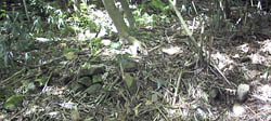
Grave
We not only clear all the alignments and retaining walls, but we also wander away from the site on a reconnaissance --- looking for other sites. And we find them. The guys are also very involved in our discussions: Is this a site? Is this a platform? What's this thing? Or that thing? Is this part of the Japanese gardening? In one instance, we all agreed that we would have had a platform in a particular place (next to some taro patches) but the whole thing was gone owing to Japanese farming, which laid out rows and rows for sweet potatos or some other produce.
I want to know if there are any oral histories about the six-sided houses: Why do they have six sides? Are they an elaboration of oval-shaped foundations? Did they come with the first settlers? Is it supposed to remind you of a boat? They do look strikingly like big boats or canoes, and that in itself sets the imagination afire with possibilities. At first my informant stuck firmly to the notion that houses had to have six sides; simply because that is they way it is, that they can be no different. So, I went through house foundation forms in the western Pacific and Southeast Asia --- rectangles, squares, ovals, circles, and so on, but no six-sided forms. Those are definitely unique to Yap. I went on further to explain that what I am looking at are potential changes in forms archaeologically, and I want to know if there is anything of that sort in the oral histories.
Six-sided foundations with posts --- I am not sure if there is a set number of posts with these kind of structures. Houses too are supposed to be six-sided; these are essentially smaller, less elaborated versions of the pebaey and faluw.
If nothing else, these guys are going to have a great model to work from --- a site considered among the earliest, abandoned long before the Germans came around and made their maps, worked as a farm by the Japanese. Now we go back for the archaeology, and ask that as we do our work the oral history gets done too --- for a complete record of the place, both the physical remains and the oral histories.
February 12, 1999
All of us are tired. We cleared off a big house foundation and associated platforms. The Japanese had been there before us and incorporated the thing into a road, so a bunch of it was missing --- or was probably missing. It was a big place, so, in theory, it should have had a whole mess of platforms related to it. We also found a lot of Japanese farms/gardening plots, their destruction of a portion of the stone path that goes up to the cemetery, and found a web of taro patches --- this would have been the gardening area of the village. No houses nearby, just a whole slew of taro gardens, one connected to another. That was the highlight of our day. At least you could say, every day we discover another component of the site --- gardens, cemetery, what is likely a medicine man's house (and, as it turns out, it sits on the edge of the village --- well, Japanese gardens lay beyond this house --- but I think it really is at the edge of the village), stone paths, wells, and so on.
 February 15, 1999 February 15, 1999
We spent our time clearing a stone path segment by the cemetery in the site, and started clearing around the well. Andrew kept saying it was a Japanese well, but I kept saying that is was local, that it was similar to many traditional wells on Palau, that Japanese didn't build wells like that. To top it off, adjacent to the well, I found a stone pavement/platform with retaining wall up against a taro patch. These people sure put in a lot of effort to pave large pieces of ground. There is a ton of pavement all over the place. I am sure much of it has to do with erosion control, as well as the same reasoning for walkways and such in Palau --- to stay off the ground a bit.
February 16, 1999
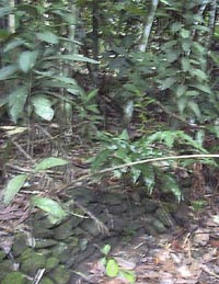
Today, we found two more house foundations and another taro patch --- and these foundations complete a nice little loop in part of our site. We are gradually picking our way over the ground from the top or upper reaches of our site to the streambed (on the western half of the stream basin), examining every bit of ground in-between. Our site boundaries are being defined by Japanese gardening remnants, which pretty much wiped out any prehistoric remains. So, we are narrowing the gap --- we have just a little more to go on this side of the stream basin. I think we are going to start the mapping work before everything starts growing up and obscuring our somewhat lousy clearing efforts.
Abandoned taro patch
Then we will work on the east side of the drainage. That side is going to be worse because it has been heavily farmed, which means heavy young, pioneering vegetation.
I was proud of myself today, too. It was just Andrew and me today. We start up this one slope above the well, and Andrew asks which way --- he usually goes in advance. I think I might be too slow for him (I am always looking around), and I can't cut the path fast enough (well, his machete is a whole lot sharper than mine). Anyway, I tell him we will go this direction instead of that one --- andyou know what? We ran right into a house foundation. We got it cleared and started roaming around some more off of that one, each of us going a seperate direction --- the call goes up that Andrew found another house. We go clear that one, find what remains of its sitting platform, and return to the first one (because we missed its sitting platform). We not only found what remained of its sitting platform, but that both houses sat on the edge of a taro patch (or what would have been a taro patch). And in the house Andrew found, there was also a pounding stone for taro and other foods.
February 18, 1999
We will be leaving for Ulithi tomorrow and return Saturday. It is an official visit for their Culture Day, which is Saturday. But, get this, because of the cost, we are traveling there on the ship, but flying back. My preference would be to fly both ways, but that is costly --- so... I am not too thrilled about a ship as I just don't know how either of us will react. I am hoping it will be an okay experience. The students I talked to today at the college are all going, and there is supposed to be someone along with them who will be giving a lecture on astronomy. I had told them I would be going, so if they did have questions they could track me down on the ship. I am starting to pack some stuff tonight --- or at least put it together in a pile. Just enough things for us to take with us, but not too much as we will be flying back and need to keep the weight down.
February 21, 1999
Teresa is dancing all over the place now. She is taken by the men's dances --- I think because they are so lively, and they are done by slapping your hands, thighs, shoulders and so on (no fighting sticks that you have to use with someone else), and lots of hoos, and haws, and other exclamations like that.
February 22, 1999
Today we got another portion of a stone path/road, as well as another house complex complete with a kitchen (although we have to see tomorrow how the kitchen is connected with the house that we found), and we found what are probably some Japanese defensive constructions (although I am not so certain --- I have asked this question be put on the oral history inquiries).
Teresa got her grass skirt yesterday and put it on. She had to take her shirt off because that is the way they are supposed to be worn, she says. She went outside with Yvette and told Yvette she should take off her shirt, as they were going to practice dancing. She said, Yvette, you can take off your shirt too, that boys out there aren't wearing a shirts either, so it's okay.
February 23, 1999
We finally got the western half of our site cleaned up today, so we can start mapping. The problem now is that the people from the U.S. National Park Service arrive tomorrow. I don't think much will get done on the site. We did some last-minute touch-ups, connecting this terrace with that one and so forth. We also got a better picture of our Japanese layer: three foxholes, a slit trench that parallels the stream for some distance, alterations of at least one of the terraces near the foxholes (for some kind of structure --- we found bricks, rusted metal, Japanese bottles and such). We followed the main stone path for a ways to the south away from the traditional village area. Overall, it was a pretty good day in that regard.
February 24, 1999
Andrew and I began mapping the site. We started at one complex --- it was a slow go because I was going through every single step involved. How you plan out the attack, as it were, for the mapping work by finding all the related alignments, make a sketch of the whole thing, number or label each of the parts so you can use it to double-check yourself as you proceed; then begin the mapping. It seemed fairly easy to him, but he didn't want to do the compass --- not for this first go-around --- and he had a time describing each of the mapping points. That is what I make anyone who takes the measuring tape do: they have to not only read the distance between the mapping points, but they also have to describe the point itself in terms that are meaningful for the note taker. After all that, he said he still wasn't sure what we did --- so I suggested we draw it out tomorrow so he can see what the product of our work looks like.
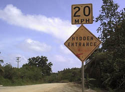
An odd sign we encounter on our way out to the site
February 25, 1999
NPS is here --- David Look and Paula Creech. Between conversations, I was showing Andrew and Mario how to draw a map, and actually having them draw the map of one of our platforms. I would check on them periodically, and they did okay. David Look was telling us about making clay tiles --- you know, those rounded tiles you see on Spanish houses? Well, they used to be made by taking a slab of clay and shaping it by laying it over your thigh, that being the form used to make the tile. It came up when Paula asked John Tharngan about making coconut sennit --- the fibers are generally rolled together on your thigh. Hence David Look's contribution about thighs and tile makers. An interesting little tidbit of information.
February 26, 1999
This is going to be a busy weekend for us --- it is Yap Day weekend. We are starting with dinner tonight, just me and Teresa with the Park Service people. At the site today, we simply did some odds and ends --- went over triangulation with the boys, took the map they drew yesterday with us and went over that platform complex with Mario (he wasn't with us when we mapped). We put in the rocks in the alignments on that map, then we cleared off another platform and its terraces, mapped it, and started yet another. Apparently the training Mario went to with the university guys from Oregon didn't cover mapping, and this has required me to do the training on the ground as we work the site.
Dinner with the Park Service people was fun. Paula is a nice person, and quite sharp. She is comfortable with Micronesia, and gets around easily enough with the food and everything else. This is the first time I've had a chance to get to know her close up.
We have to get ready for our site tours today.
Next: Ulithi
|
|